Waze vs Google Maps: Which Navigation Style Fits the Way You Drive?
Waze and Google Maps share an owner, but their navigation experiences put different information and controls in front of drivers.

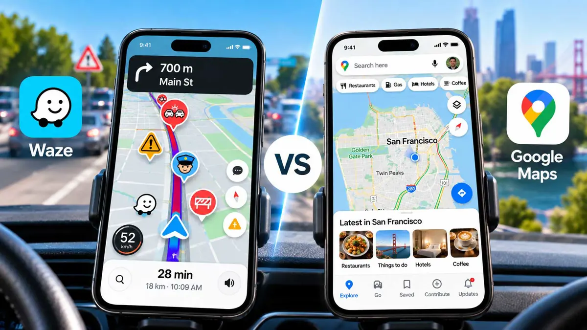
Waze vs Google Maps is less about choosing a universally better app and more about choosing the kind of navigation information that fits a particular drive. Both can guide a driver from one place to another, but they present the road in different ways.
Waze puts more emphasis on what is happening on the road right now. Its map can surface traffic, crashes, hazards, closures, police reports, and other driver-submitted information, while its routing system can adjust the trip around changing road conditions.
Google Maps takes a wider view. Driving is one part of the app, alongside place discovery, walking, cycling, transit, accessibility features, and a large amount of location information. That broader design changes what appears useful on the screen before, during, and after a trip.
Waze Treats the Drive Like a Live Road Report
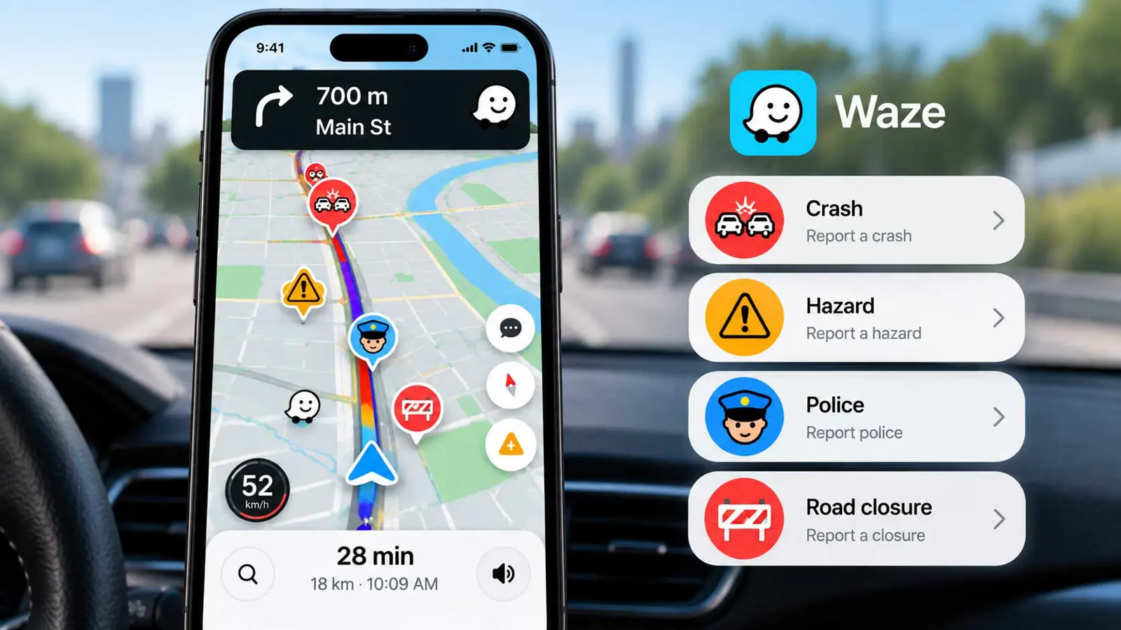
Waze's strongest distinction is its focus on current road conditions. Users can report traffic, crashes, hazards, blocked lanes, bad weather, construction, and other incidents. Waze also uses traffic information and reports to help drivers understand what is happening along a route.
That information can make the navigation screen feel busier than a conventional map. The benefit is context: a driver may see why a route is slowing down or why the app is suggesting another path.
Waze also gives drivers control over the alerts they hear. Its current sound settings include Normal, Less chatty, Only alerts, and Off on supported configurations. That matters because a driver who wants road warnings without every navigation prompt can reduce the amount of spoken information.
Waze's reporting system is also part of the app's identity. Reports are intended for incidents users see in real time, and Waze says reports can disappear or remain visible based on later user feedback. Road closures are treated differently because confirmed closure reports can affect routing.
For readers interested in how Waze is evolving beyond basic routing, Saganote has also covered recent Waze updates involving motorcycle mode, personalized navigation, and Gemini.
Google Maps Is a Broader Navigation Tool
Google Maps can certainly handle traffic-aware driving, but its purpose extends well beyond the drive itself. The same app can help find a restaurant, inspect a neighborhood, compare places, plan transit, navigate on foot, and answer questions about locations.
That broader scope changes the navigation experience. Instead of treating the route as the entire task, Google Maps can connect the route with the destination and the things around it.
Google's recent Maps updates have pushed that idea further. Ask Maps uses Gemini to handle conversational questions about places, while Immersive Navigation adds richer visual guidance and route information. These features are part of Google's effort to make Maps useful for both navigation and location-related questions.
Saganote has covered the rollout of Google Maps Immersive Navigation on Android Auto, as well as speed-limit information in Google Maps on Android Auto.
The Biggest Difference Is Information Density
| Area | Waze | Google Maps |
|---|---|---|
| Primary emphasis | Driving and changing road conditions | Navigation plus broader location information |
| Road reports | Strong focus on driver-submitted incidents and alerts | Traffic and road information are part of a broader map experience |
| Rerouting | Designed around responding to changing driving conditions | Provides route choices and traffic-aware navigation |
| Place discovery | Available, but secondary to driving | Core part of the Maps experience |
| Voice experience | Multiple guidance and alert levels | Voice navigation plus newer conversational Gemini features |
The table points to the practical difference: the two apps are solving overlapping problems with different priorities. Waze puts more of the driving session's attention on road events and alerts. Google Maps puts the route inside a larger map and place-discovery system.
Neither approach automatically makes a route easier for every driver. A person who wants detailed awareness of incidents may value the extra Waze information. Someone who frequently searches for places, changes plans, or uses Maps for walking and transit may find the broader Google Maps model more useful.
Voice Navigation Changes More Than the Volume
Voice guidance is another place where the apps take different approaches. Waze lets drivers change the amount of spoken guidance and alerts, including a Less chatty mode on supported setups. Google Maps provides standard voice navigation and also supports accessibility features such as TalkBack on Android, detailed voice guidance for walking navigation, and larger map labels through device accessibility settings.
Google is also adding Gemini to Maps navigation. Google says Gemini can handle conversational requests while navigating, including questions about places and trip details. That makes voice interaction less about repeating turn instructions and more about asking the map for information.
Saganote has also covered Google Maps' Gemini-powered food ordering and Ask Maps features and the broader Ask Maps expansion into food ordering, hotel bookings, and other tasks.
These features do not erase the basic difference between the apps. They add another layer to Google Maps, which increasingly combines navigation with conversational location assistance.
When Waze Fits the Drive Better
Waze makes the most sense when the main task is getting through a driving trip while staying aware of changing road conditions.
- A commute where traffic can change quickly.
- A route where incident alerts and road reports are useful context.
- A driver who wants control over the amount of spoken guidance.
- A trip where avoiding a reported closure or disruption is a priority.
- A driving workflow where the map itself is mainly a tool for the route.
Waze is especially distinct when the driver wants the road itself to be the main source of information. Its alerts and reporting tools are designed around that use case.
When Google Maps Fits the Trip Better
Google Maps fits more naturally when navigation is only one part of the task.
- A trip that involves finding restaurants, shops, hotels, or other places.
- A journey that switches between driving, walking, cycling, or transit.
- A route where accessibility features or larger map labels are useful.
- A trip that benefits from conversational questions about the destination or nearby places.
- A driver who wants navigation and broader location information in one app.
Google Maps can also be useful before and after the drive. The same map can help research the destination, check nearby businesses, and plan what happens after the car is parked.
You Do Not Have to Pick One
The overlap between Waze and Google Maps makes it reasonable to use both. A driver can keep Google Maps as the broader map and place-discovery tool while turning to Waze when live driving reports and route-focused alerts are more useful.
That approach also avoids treating navigation apps as if they all have the same job. The better comparison is not simply which app has more features. It is which information should stay in front of the driver during a particular trip.
Google Maps is increasingly combining navigation, places, accessibility, and Gemini-powered assistance. Waze remains centered on the driving experience and the changing conditions reported by its user network. Those priorities explain much of the difference people notice when switching between them.
For a broader look at Apple's competing navigation experience, Saganote also covers what changed in Maps with iOS 27.